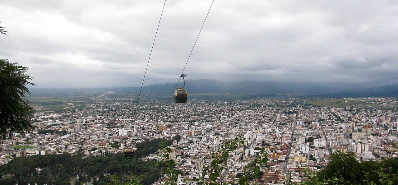
San Antonio de los Cobres is a small Puna town of 5,600 inhabitants at 3,775 meters elevation in northwestern Salta Province, Argentina. It is one of the highest permanently inhabited towns in Argentina and serves as the departure point for the Train to the Clouds (Tren a las Nubes), which runs from here to the La Polvorilla Viaduct at 4,220m. The town sits at the junction of National Route 51 (from Salta through the Quebrada del Toro) and Route 40 (connecting to the Salinas Grandes and Purmamarca). The surrounding landscape is high-altitude Puna desert: vast, arid plains punctuated by mountains exceeding 5,000m, scattered herds of llamas and vicunas, and flamingo-filled lagoons. The town has basic services -- a few simple restaurants serving llama stew and empanadas, modest accommodations, a gas station, and a small market. The frontier atmosphere and extreme remoteness make San Antonio a compelling stop for adventurous travelers seeking the real Puna experience.
Getting there — distances & times
| From | Distance | Flight | Bus | Drive |
|---|---|---|---|---|
| Buenos Aires (EZE) | 1500 km | 2 h 20 | 20–22 h | 15–17 h |
| New York (JFK) | 9400 km | 12 h + 2 h 20 layover | — | — |
| Madrid (MAD) | 11300 km | 14 h + 2 h 20 layover | — | — |
| São Paulo (GRU) | 2800 km | 4 h 30 | — | — |
| Córdoba | 890 km | 1 h 30 | 11–13 h | 9–10 h |
| Mendoza | 1200 km | 2 h | 17–19 h | 13–15 h |
Month-by-month climate
| Month | Temp. | Rain | Crowds | Note |
|---|---|---|---|---|
| Jan | 16° / 28°C | 180 mm | Rainy summer | |
| Feb | 15° / 27°C | 155 mm | ||
| Mar | 14° / 26°C | 110 mm | ||
| Apr | 11° / 24°C | 30 mm | Dry season starts | |
| May | 8° / 22°C | 8 mm | ||
| Jun | 5° / 20°C | 3 mm | ||
| Jul | 4° / 20°C | 3 mm | Winter break | |
| Aug | 6° / 22°C | 5 mm | ||
| Sep | 9° / 25°C | 10 mm | Clear skies | |
| Oct | 12° / 27°C | 25 mm | ||
| Nov | 14° / 28°C | 60 mm | ||
| Dec | 16° / 28°C | 140 mm | Holidays |
Typical prices by category
| Category | Budget | Mid-range | Luxury |
|---|---|---|---|
| Hotel/night | USD 15–25 | USD 50–90 | USD 150–350 |
| Food/day | USD 12–18 | USD 25–40 | USD 60–120 |
| Day tour | USD 40–55 | USD 60–90 | USD 120–200 |
| Car rental/day | USD 30–45 | USD 50–70 | USD 90–150 |
Approximate ranges in USD as of April 2026. May vary with Argentine peso exchange rate.
Getting There
From Salta (most scenic): National Route 51 through the Quebrada del Toro, 164 km, 3 hours, fully paved. The drive climbs from 1,187m to 3,775m through dramatic mountain scenery. By bus: Daily service from Salta terminal (4 hours). Via Purmamarca: Longer route via Route 40 and Cuesta del Lipan, connecting through the Salinas Grandes -- spectacular but more time-consuming.
Things to Do
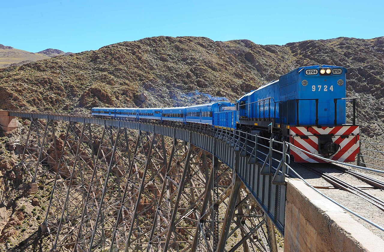
- Train to the Clouds: The train departs from San Antonio station to the La Polvorilla Viaduct (4,220m). April-November. Book well in advance.
- Salinas Grandes: 70 km south via Route 40. Salt flats at 3,450m. Can be visited as a loop: Salta -- San Antonio -- Salinas -- Purmamarca -- Salta (~500 km).
- Quebrada del Toro drive: Even without the train, the RN 51 drive between Salta and San Antonio through the Quebrada del Toro gorge is spectacular.
- Puna wildlife: Vicunas (wild camelids), flamingos at high-altitude lagoons, condors. Best spotted in the early morning.
- Local artisans: Cooperatives selling woven textiles, llama-wool goods and salt carvings.
Altitude & Health
At 3,775m, altitude sickness is common for visitors from sea level. Symptoms: headache, shortness of breath, fatigue, nausea. Prevention: drink 2-3 liters of water daily, avoid alcohol, eat light meals, chew coca leaves (available at any pharmacy or market in Salta). The gradual ascent via Route 51 helps acclimatization. If symptoms are severe, descend immediately -- returning to Salta provides fast relief. The Train to the Clouds has medical staff and oxygen on board.
Practical Information
- Accommodation: Basic hostels and guesthouses, USD 15-35/night. No luxury hotels.
- Food: Simple comedores serving llama stew, empanadas, locro. Budget $5-10 per meal.
- Cash: There is an ATM but it frequently runs dry. Bring cash from Salta.
- Gas: One YPF station. Fill up in Salta as backup.
- Cell signal: Limited. Personal/Claro best. Download offline maps before departing.